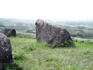
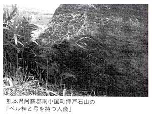
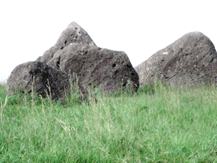
PURPOSES In a deep forest in Minamioguni Town, Aso County of Kumamoto Prefecture, there is a hill called "Hill of Oshito (or Oshido) Stones" (845 meters high above sea level.) The Oshito Stones are on the top of the hill. The largest one is called "Taiyo-ishi" Stone and about 15.3 meters around.Oshito means a great demon or giant. According to a legend, giants played with the stones every night. The stones on the hill are placed in certain lines, and the whole scene of the hill is magnificent. Figure 1 and 2 are pictures of those stones. Based on the authorization by Nobuhiro Yoshida, the head of the Japan Petrograph Society, the Office of Minamioguni Town announces on their website that "Petrographs (ancient letters inscribed on surfaces) have been found on the stones." The Board of Education of Minamioguni Town has posted a sign on the hill announcing, "The stones in this area have been inscribed with ancient Sumerian letters of about 4,000 years old." However, Nobuhiro Yoshida states in his books that the miraculous power of ancient rocks cures cancer and the power can be used to cure romantic diseases. He has published books, that ignore scientific perspective, such as "The Power of the Miracle Petrograph" (Tama Books, 1995) and "The Petrograph's Power Cures Incurable Diseases" (Tama Books, 2001). The small town suffering from depopulation was attracted by the fascinating information that Nobuhiro Yoshida has fabricated. The truth about the Hill of Oshito Stones should be conveyed to the innocent tourists and younger people who visit the area. It is necessary to investigate and verify whether the Oshito Stones were artificially placed and whether there are man-made petrographs (ancient letters) on the Oshido Stones. LOCATION The Hill of Oshito Stones is in the Nakabaru District of the Town of Minamioguni, Aso County of Kumamoto Prefecture.
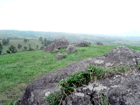
Running 10 kilometers north on the Route 212 from the east-west Route 57 which is in the Great Crater of the Volcano Aso, we can arrive at an observation platform "Daikanbo" (936 meters high above sea level) on the outer rim called "Gairinzan" of the Great Crater. Further north for 6 kilometers, we can turn left to the Mazeno Mystery Road and run 2 kilometers west and find a path to the Hill of Oshito Stones. The path is 1.5 Km long and so narrow that only a single car can move very slowly but lead to a small open space for parking. The small mountain on the right is the Hill of Oshito Stones. The top of the Hill is within walking distance from the open space, and within several minutes the magnificent Oshito Stones come in sight. THE PANORAMIC VIEW IS SPECTACULAR The panoramic view from the hill is spectacular. The hill commands the view of Mt. Kujunakadake (1,791 meters high above sea level) and Mt. Kuju (1,787 meters) far in the northeast direction. Mt. Waita (or Oguni-Fuji) is also in sight. The hill commands also the view of the outer Gairinzan rim of the Great Crater of the Volcano Aso and Mt. Nekodake far in the south direction. The whole scene is so beautiful. The Mazeno Valley close to the hill is made of one rock plate for pure water stream, and this is the source of the Nakabaru River.
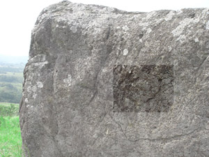
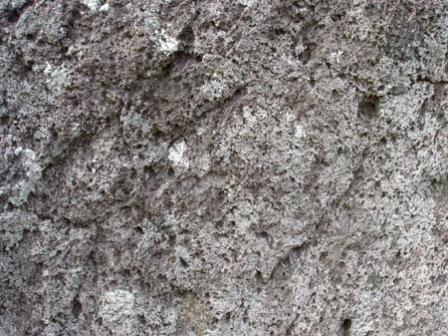
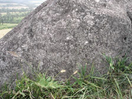
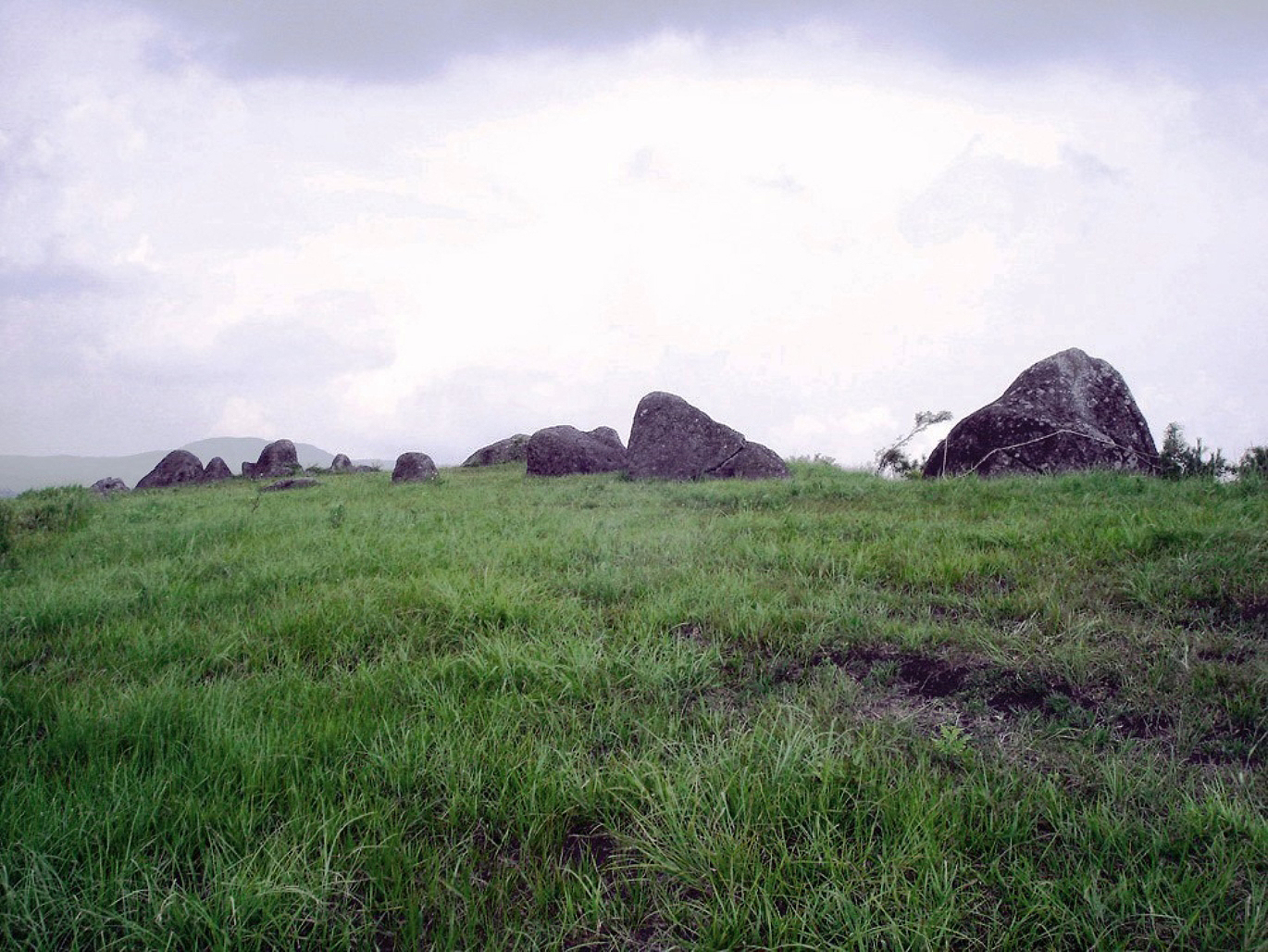
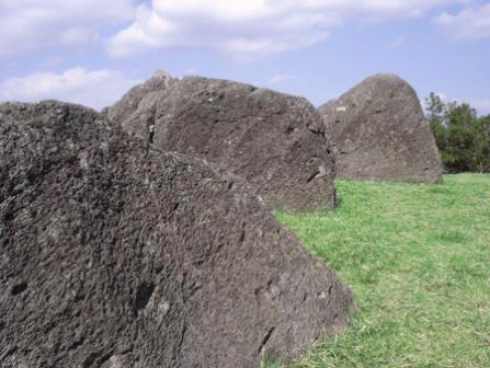
THE STONES ARE NOT ARTIFICIALLY ARRANGED BUT NATURALLY PLACED The "Volcano Aso" includes not only the active volcano Mt. Nakadake but also the Great Crater, thats is about 20 kilometers in diameter. Great eruption took place 4 times in the past 300 thousand years. The last and 4th, great eruption of about 90 thousand years ago was the largest, and thereby the present Great Crater was created. Before the great eruptions, the Volcano Aso was spewing out viscous magma of rhyolite mainly from the eastern side of of what is now the Volcano Aso. The activity of the period is called "Bungo Activity." Furthermore, prior to Bungo Activity, the Volcano Aso was spewing out magma of andesite mainly, covering the wide area of the central Kyushu mainland. The volcanic activity of the period is called "Hohi Activity." The terms "Bungo Activity "and "Hohi Activity" are given a generic term "Pre-Aso Activity."Rocks exposed on the ground of the outer rim Gairinzan of the Great Crater are made of andesite from Pre-Aso Activity and tuff or welded tuff (or ignimbrite) from the great eruptions. The andesite is presumed to be typically 84 thousand years old. Tuff is a type of rock consisting of volcanic ash slowly consolidated by pressurization and crystallization. Welded tuff is also a type of rock consisting volcanic ash hardened under pressure and heat. When the last great eruption took place 90 thousand years ago, volcanic ash covered the mainland of Japan, Korean Peninsula, Hokkaido and southern Sakhalin. The present-day central Kyushu mainland is a large plateau of welded tuff that is 90 thouthand years old. The Oshito Stones are those of andesite from Pre-Aso Activity. The magma of andesite was viscous to some extent. As a result, the andesite magma flowed slowly and formed layers. The andesite is composed of phenocrysts and groundmass. Phenocrysts are crystals formed before the magma was cooled down. Groundmass is the glassy component to fill the crystal boundaries. Andesite has silicon dioxide in 53-63 % and is gray in color. Basalt has less silicon dioxide than andesite and colored dark. The rhyolite has higher silicon dioxide content than andesite and lighter in color. The ingredients of the phenocrysts and groundmass of the Oshito Stone andesite are amphibole, pyroxene, magnetite (iron oxide), and plagioclase. The large plateau of andesite formed by the Pre-Aso Activity was covered with tuff or welded tuff from the last great eruption. The tuff and welded tuff were more easily dissolved than andesite and weathered to form rich soil grains, sand and mud in the central Kyushu mainland, including the Town of Minamioguni. Oshito Stones were mountain-size bedrock formed by the slow stream of andesite magma. The bedrock of the andesite was also covered with tuff and welded tuff, but the bedrock was bent by strong orogenic forces. Some portions of the plateau were tilted, and others were pushed up, exposing tuff and welded tuff-covered andesite through cracks in the ground surface. By erosion and weathering, tuff and welded tuff became soil, leaving hard andesite, the Oshito Stones, in certain straight lines. When a localized force pushed upward and downward at a certain point, andesite emerged in a circle around the point. The present Oshito Stones are hard andesite stones remaining on the ground for a long time. The Oshito Stones clearly show the structure of andesite layers. The structure has distinct regularity and this is presumably the result of slow cooling down of the andesite magma flow. As shown in Figure 3, stones are aligned and layered in the same direction. This is because the same andesite bedrock emerged along a linear fracture line. As stated above, the Oshito Stones are those of andesite rocks placed on the ground in a straight line or circular line by the orogenic forces. The Oshito Stones were not artificially arranged by giants but naturally placed by the orogenic forces. Neither the UNESCO Rock Art Society, the American Rock Art Research Association, nor Canadian Rock Art Research Association has issued a certificate acknowledging that the Oshito Stones are remnants of prehistoric stone culture. Professor Lyle B. Borst (1912-2002), a nuclear reactor scientist at the State University of New York, has not confirmed that the Oshito Stones are remnants of prehistoric stone culture. We must not deceive innocent tourists and young people by false information. The Oshito Stones were not artificially arranged. However, the Hill of Oshito Stones is a magnificent scenic site and should be proudly presented to the world. NO PETROGRAPH OF ANCIENT LETTERS ARE FOUND ANYWHERE To conclude, first of all, there are numerous cracks, scars from lightning strikes, and erosion patterns on the surfaces of the stones, but nowhere on the surface of the stone is a petrograph engraved with ancient writing, such as the Sumerian cuneiform script of about 4,000 years ago.It is generally believed that writing was transmuted from pictographs, but in Mesopotamia, where writing was first invented in the world, the order was a little different. About 6,000 years ago in Mesopotamia, there were pieces of hard clay about 1-3 cm in size called "tokens."
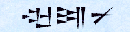
The tokens were shaped like seals, and the tokens, pressed on a soft slab of clay, left "letters." Clay was abundant in Mesopotamia. Hence, in ancient Mesopotamia, tokens recorded the culture of the ancient Mesopotamians. Modeled after the token impressions, the painterly "Uruk rustic script" was also inscribed on soft clay slabs. The rustic script of Uruk was in use about 5,200 years ago. When a hard end of a reed stem is pressed obliquely onto a soft clay slab, each press marks looks like a cuneiform print. The cuneiform script ,"written" on a clay slab was invented by Sumerians about 4,700 years ago (Figure 4). A single cuneiform stroke is equivalent to a stroke of Chinese characters. Cuneiform characters were much easier than Uruk rustic letters to write. There were about 600 cuneiform characters at the time (fewer than modern Japanese Kanji). Cuneiform characterss were easy to learn and widely used in the cities of Sumerian state about 4,400 years ago. The Sumerian cuneiform became the common script of the Orient about 4,300 years ago and was used by Palestinians and Egyptians as well. In Sumerians cities, there were cuneiform schools and libraries. Sumerian language was quite similar to Japanese. Some of the cuneiform characters were ideographs for meaning like Japanese Kanji, while others were phonetic characters for sound like the Japanese Kana characters. These were used intermingled, like Japanese kanji and kana characters. There were different ways to read a cuneiform letter, like a Japanese Kanji, and some other cuneiform letters were added for inflection like Japanese Kana letters. The 3rd Dynasty of Ur (BC 2,113-BC 2,006), the most prosperous kingdom of Sumerians, ruined finally about 4,000 years ago.
Stone surfaces show numerous cracks, lightning strike scars and erosion marks. But nowhere is a petrograph artificially carved with ancient writing, such as the Sumerian cuneiform script of about 4,000 years ago.
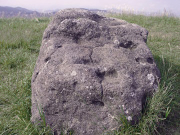
The southwest face of the stone, known as "Kagami-ishi", has an eroded pattern that looks like a cow's head. This is not a pattern carved by the ancients. Figures 5, 6 and 7 show the stone. Near this pattern, there is another erosional pattern that looks like a snake. This is not the carved pattern of the ancients. Figure 6 identifies the location of those erosional patterns. These patterns are not distinct in width or depth, as shown in Figure 7. These erosion patterns are changing every few years. Figure 7 shows a photo taken in September 2007. These patterns have been changed in the last years.
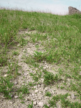
As shown in Figure 8, there are numerous fragments of andesite stones around the Oshito Stones. Those would have been large stones like the present Oshito Stones many years ago. Those fragments are so fragile. They can be picked up to be damaged easily by fingers. They can be clapped by hands to be crushed easily into grains. We have to be in awe of the grandeur of the Mother Nature. If the hill is weathered by 5 millimeters a year, then it would be washed away 20 meters in 4,000 years.
As mentioned above, there is no petrograph engraved anywhere on the Oshito Stones. STONES ARE MAGNETIZED BY THUNDER LIGHTENINGS One of the Stones is called "Saidan-ishi" shown in Figure 11. Most Stones including this Saidan-ishi and the largest "Taiyo-ishi" are magnetized. Those stones have many cracks and depresssions. When a compass is brought close to the surface of a stone, the magnetic needle is deflected at a large angle. The stones are not possessed by a supernatural "magnetic abnormality."The Oshito Stons contains abundant magnetite (iron oxide) which is magnetic and electroconductive. The bare stones on the hill are, like lightning rods, ready to be struck by thunder lightenings.
POSTSCRIPT The dreams and souls of the community must be respected. However, fabricated information should not be presented as if they were facts for reasons convenient to the interests of the town and surrounding organizations.There are many genuine man-made stone circles in the world, but the Oito Hill Stones are not the same as the artificial stone objects. However, the Hill of Oito Stones is a beautiful site naturally made by the Volcano Aso. This hill is a magnificent scenic spot that should be proudly introduced to the world. |

 karanu (wine)
 unqu (ring)